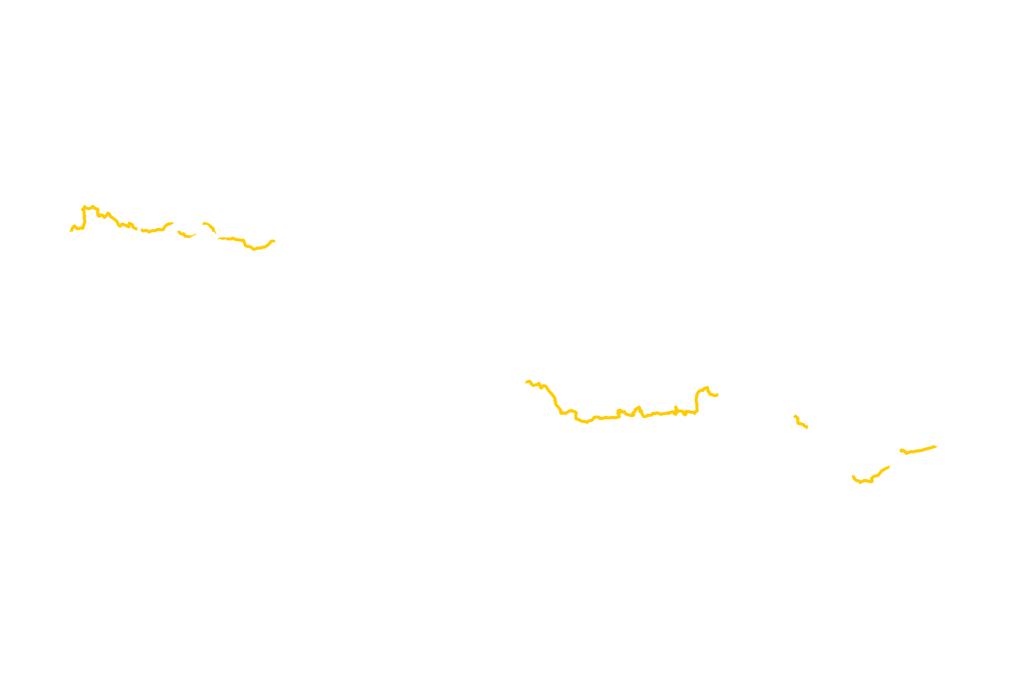
| Montfalgaux - Barjac | 226km | ||
| 61.1km off-road | April / September |
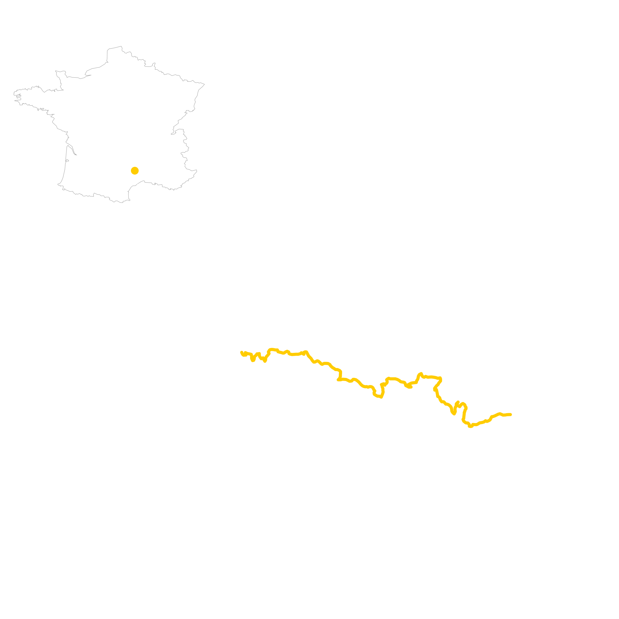
Quick GLR 1 overview
The GLR 1 motorcycle adventure route will lead you for over 226 kilometers through the Lozère, Gard, and Ardèche regions of Southern-France. 61 kilometers of those will traverse over off-road sections. If the going gets tough, The Back-up Tracks will support you with 9 different sections. With a total of 5 connecting GLRs to this GLR 1, you’re able to continue to Adventurise the region. Let’s get going!

GLR 1 Route info
You start your GLR 1 adventure in Montfalgaux in the Lozère region. From here the route changes to off-road sections at a regular interval. In the middle of the route, a 58km long paved section will lead you passed some scenic landscapes.
Don’t be sad! The route will continue on the same interval of off-road section after this smaller on-road one. You’ll end your adventure in Barjac where you have more than enough choice to connect even more GLRs to your adventure!

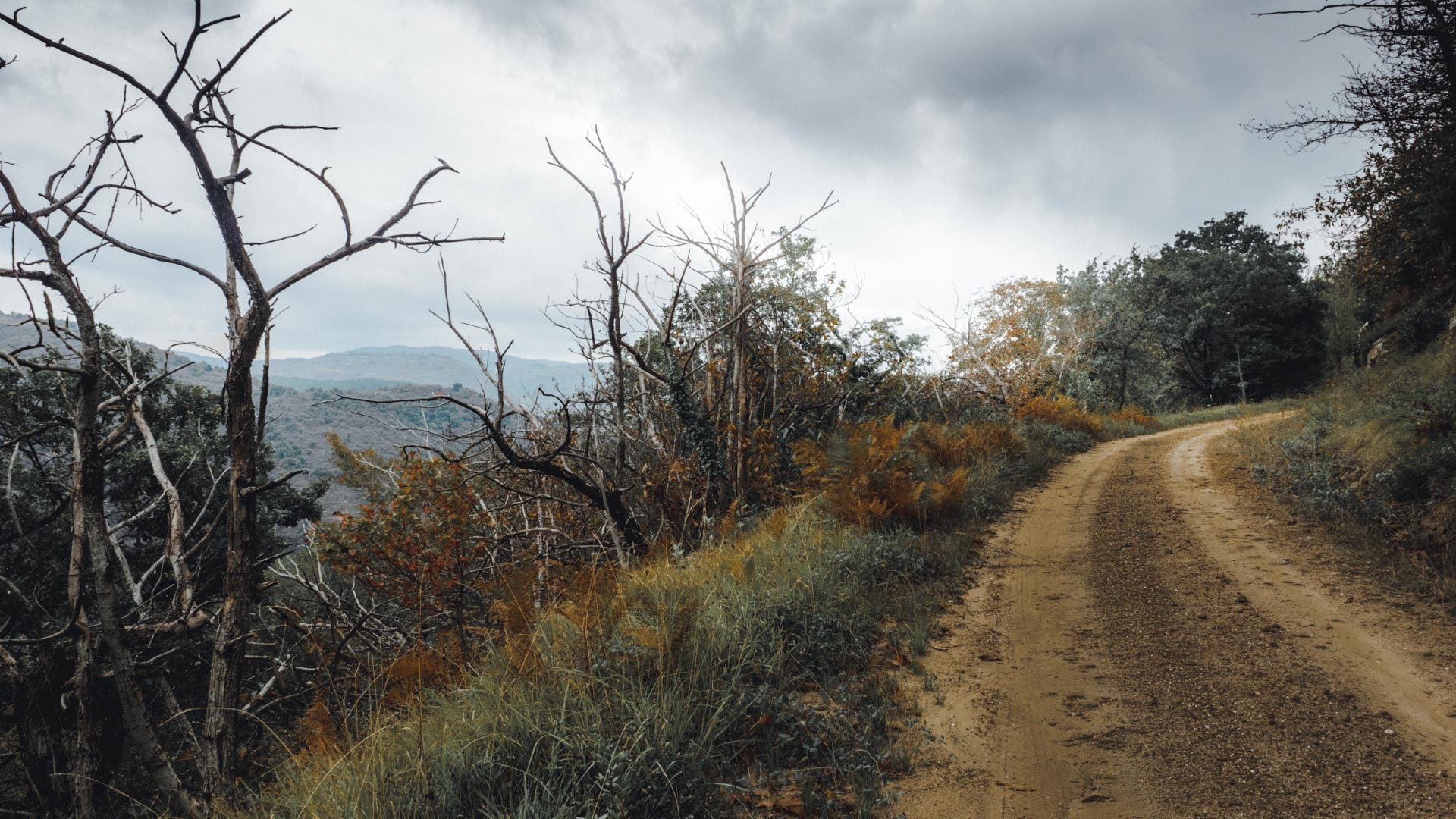
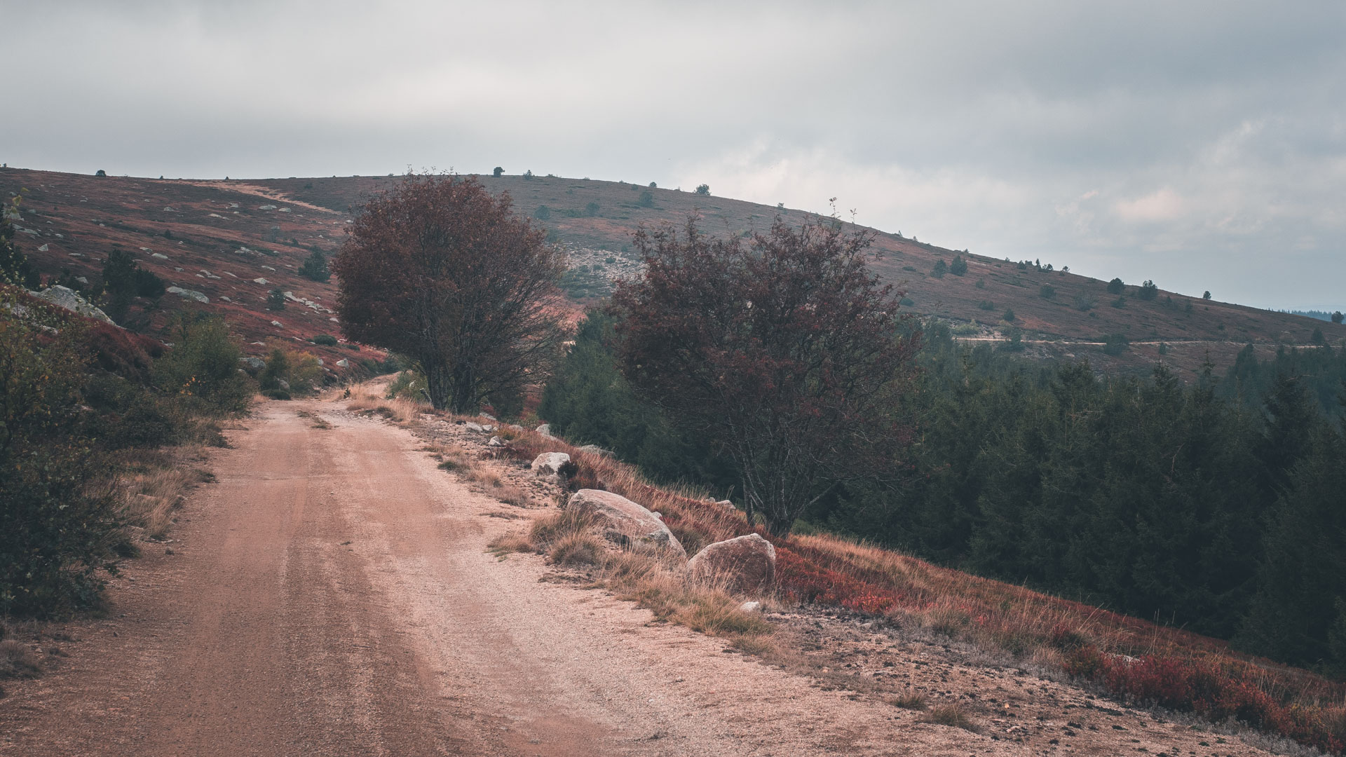
This GLR 1 highlight is a 13.4-kilometer long off-road section right through the Cevennes National Park. This road is specifically constructed to provide a nice overview of the surrounding area. At an elevation of 1450 meters, you glance over the plateau to the north. This section lies right in the middle of the GLR 1, with 119 kilometers from Montfalgaux and 93 km to Barjac. Interested in more things to see around the GLR 1? Take a look at the “Things to Do” section down below.


GLR 1 Region
You’ll Adventurise with the GLR 1 three departments of south-east France. This route will cross Lozère for almost it’s entire width. Near the end, you’ll hop borders between Gard and Ardèche. Read all about the region down below!
Lozère
Lozère is known to be the least populated department of France. With most of its population living in its prefecture Mende. The department was created during the French Revolution of 1790 from the former province of Languedoc. The geography of Lozère is diverse, with a total of four different mountain ranges covering the department.
In the north-west, you’ll find the plateau of Aubrac. In the north, north-east you find the granite Margeride mountains. Further to the south-west, the Causses are a series of limestone plateaus rise from the landscape. Finally, in the south-east, you’ll find the highest peak of Mont lozère at a total of 1,702 meters in the Cévennes.
A remarkable fact is that the region has one of the lowest rates of unemployment, caused by a long-standing tradition whereby the younger population emigrates to larger cities outside the department.
You start your GLR 1 adventure in Montfalgaux in the Lozère region. From here the route changes to off-road sections at a regular interval. In the middle of the route, a 58km long paved section will lead you passed some scenic landscapes.
Don’t be sad! The route will continue on the same interval of off-road section after this smaller on-road one. You’ll end your adventure in Barjac where you have more than enough choice to connect even more GLRs to your adventure!
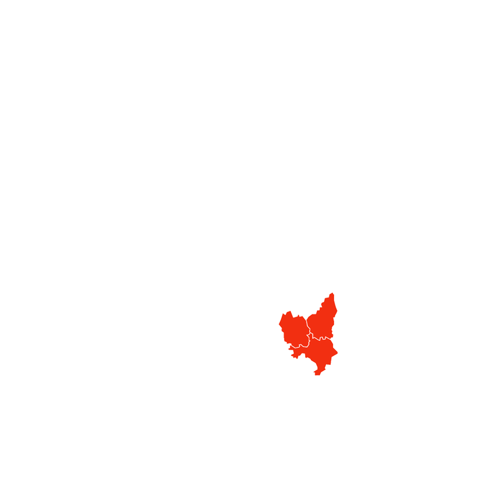


Gard
Gard is located in the Occitanie region of Southern France. The department is named after the Gardon river. What makes the department worth visiting is its rich history. The Gard region was settled by the Romans back in classical times.
During the mid-1800s, the region became beneficiary of early railway development. The build of an important railway junction caused an increase in the local economy. Due to the growth in wealth and the arrival of influential people, several luxurious hotels were built.
Nowadays Gard is famous for its Pont du Gard, a Roman aqueduct across the Gardon River. Gards préfecture is Nîmes. Known for its well preserved Roman monuments like Maison Carée and the Arena of Nîmes.
Its second major city Alès functions as a gateway to Cévennes National Park in the west. In the south, the department borders to the Camargue Natural Park. Due to its geographic setting, Gard holds some records of the highest measured temperatures of France.
A fun fact of the region is that Gard is also the home of the source of Perrier. An internationally sold carbonated mineral water. Both the spring and facility are located near the commune of Vergèze.
Ardèche
The Vivarais, as the Ardèche is locally called, is named after the Ardèche river. The department is part of the larger Auvergne-Rhône-Alpes region. The area has been inhabited at least since the Upper Paleolithic and is famous for its cave paintings.
The Ardèche department didn’t develop major cities due to the lack of industrialization in the 19th century. The industry moved further upstream to bigger cities such as Lyon. Nowadays this is still a cause of the inaccessibility of the region. The region doesn’t know any high-speed transportation methods.
Ardèche at its widest does not exceed a width of 75 kilometers. Therefore, because of its elongated shape, it knows many natural regions. From the mountains in the west to the plateau of the Coirons in the south-east. One remarkable feature is the Valley of the Rhône, a straight corridor running from the south, up to the north. Creating a funnel-like effect, exaggerating the effects of the cold wind from the north. Also known as the Mistral.
The region is also known for its other weather phenomena such as la Burle, which are very violent winds over autumn and winter. September and October are known for its rainfall.

Adventurising isn’t only about getting as fast from A to B! A Region has so much more to offer! That’s why I give you some suggestions about things to do while Adventurising the GLR 1.
Aven Armand
Do you want to escape the heat above the ground? The Aven Armand Limestone caves are a perfect variation to visit on your motorcycle adventure! One of the biggest halls filled with speleothems in all shapes and sizes is over 100 meters long and 55 meters wide!
more info
Mont Lozère
Visit the highest peak of the Cevévennes at 1699 meters! Mont Lozère is part of the Massif Central. Besides it’s used for skiing in winter, it’s a perfect spot to hop of your bike and explore nature by foot.
House of the Vultures
Do you want to see some wildlife from up close? Visit the House of the Vultures to discover the site where a colony of vultures has been reintroduced!
more info
Pont d’Arc
The Pont d’Arc is a large natural bridge, located 5 km from the town of Vallon-Pont-d’Arc. The arch is 59 meters wide and 34 m high at the top of the opening. The perfect spot to have a little rest during the day!
more info

Thank you for downloading the GLR 1! Good luck with Adventurising Europe. Speaking of Adventurising Europe, to keep the project going and free, we’re relying on a mix of sponsored advertisements and Adventuriser donations. Do you like what we’re doing and you want to support the project? Please consider a donation. You can read more about donations and support here.
The Adventurising Europe project is all about documenting Europe through the eyes of adventure riders. Do you want to contribute to this mission? Become an Adventuriser! As an Adventuriser you’re part of our community and you enjoy the benefits of accessing the back-up tracks of the GLR-Network. Also you receive our regular updates on the project. It’s completely free, so enlist now!
Continue your GLR 1 Adventure by connecting different GLRs. To make your life even simpler, I’ve put together all the options down below!
Connections in Montfalgaux
Do you end your GLR 1 adventure in Montfalgaux? Don’t worry! From here you can connect to the GLR 10 which will lead you down south to Octon, the connection between the Mediterranean part and the Pyrenean part of the GLR network. This route will lead you over 326 kilometers, of which 116 are off-road.
Heading up north? Take the GLR 26 to Lalouvesc, where the fastest way to the higher alps begins. The GLR 27 has a total length of over 357 kilometers. 102km of those are off-road!


Connections in Barjac
In Barjac you get the option to continue your adventure with three different GLRs! Take the GLR 2 down south to reach the Mediterranean Sea! The GLR 2 stretches over 140 kilometers, with 30% off-road. You’ll end up at the gateway of the Camargue region, at Villevieille.
Don’t you want to go to the Mediterranean coast? Take the GLR 27 up North for the fastest way to the higher Alps! You’ll end up in Lalouvesc after 195 kilometers. This GLR has a relative low off-road percentage due to the local laws. GLR 27 navigates over a total of 38 kilometers off-road.
Do you want more off-road riding? The GLR 4 leads you east. Over a total of 201km, of which 48 off-road, this adventure route will end in Sault. The perfect destination if you want to explore the lower Alps before you head into the high ones.
Explore.Ride.Adventurise.
Exploring Europe through the eyes of an adventure rider. Making Europe a better place for adventure riders by creating the GLR Network.
As an Adventuriser you get access to our special Back-up Tracks for the GLR-network. These routes function as a back-up when the going gets tough. In the event you need to circumnavigate a piece of the original GLR, the Back-Up Track will lead you via paved road to the next section.
Sign in to download this Back-up Track!
Support the Adventurising Europe project
As a Patron, you gain access to the latest 5 GLRs before Everyone else! That's at least 2,5 months! Besides that, you support 1 kilometer of that GLR. You enable me to continue the Adventurising Europe project and keep the GLR Network free. Please consider becoming a Patron if you think I provide any value to you.
The GLR 46 Motorcycle Adventure Route
The GLR 46 motorcycle adventure route leads you for over 356 kilometers through the Upper- and Inner Carniola regions of Slovenia. 77.5 of those kilometers will traverse over off-road sections. If the going gets tough, The Back-up Tracks will support you with 8 different sections. With a total of 4 connecting GLRs to this GLR 46, you’re able to continue to Adventurise the region. Let’s get going!
The GLR 45 Motorcycle Adventure Route
The GLR 45 motorcycle adventure route leads you for over 145 kilometers through the Friuli Venezia Giulia region of Northern Italy and the Nova Gorica province of Slovenia. 26.4 of those kilometers will traverse over off-road sections. If the going gets tough, The Back-up Tracks will support you with 6 different sections. With a total of 5 connecting GLRs to this GLR 45, you’re able to continue to Adventurise the region. Let’s get going!
The GLR 44 Motorcycle Adventure Route
The GLR 44 motorcycle adventure route leads you for over 160 kilometers through the Carinthia region of Austria, Friuli Venezia Giulia region of Italy, and the regions of Tolmin and Nova Gorica in Slovenia. 2.7 of those kilometers will traverse over off-road sections. If the going gets tough, The Back-up Tracks will support you with 2 different sections. With a total of 5 connecting GLRs to this GLR 44, you’re able to continue to Adventurise the region. Let’s get going!