| Passy - Colle Delle Finestre | 303km | ||
| 93km off-road | June / September |
Quick GLR 29 overview
The GLR 29 motorcycle adventure route leads you for over 303 kilometers through the Haute-Savoie and Savoie Departments of Eastern France and the Turin Province of Northern Italy. 93 of those kilometers will traverse over off-road sections. If the going gets tough, The Back-up Tracks will support you with 7 different sections. With a total of 5 connecting GLRs to this GLR 29, you’re able to continue to Adventurise the region. Let’s get going!


GLR 29 Route info
This GLR 29 motorcycle adventure route belongs in the top 3 of my favorite GLRs to date! This 303-kilometer long route guides you from the epicenter of European mountaineering in Chamonix down south to, in my opinion, the most beautiful region for motorcycle adventures!
As I said, you start your journey near Chamonix in a local village called Passy. From here, you leave the beautiful sight of Mont Blanc behind towards the south. After 15 kilometers of on-road section, you hit the dirt. This ski-piste trail leads you over the mountains. Be aware! The Back-up route starts in another direction. This due to the remoteness of the area.
After the first few on- and off-road sections you’ll pass the beautiful lake of Lac de Roselend. Take a break and enjoy the amazing views of this lake at altitude. After your short break, you continue your journey across the mountains. Because the Alps run from east to west, you’ll have to cross a lot of mountain passes during your adventure!
The frequency between on- and off-road sections is high in the first half of the GLR 29. After that, you’ll explore an on-road section of 70 kilometers. This due to the local laws in the Vanoise National Park.
At Lac du Mont Cenis, the most beautiful section of the route starts. You explore the old military road to the west of the lake. Explore the fortifications on the border between France and Italy. This old military road drops you eventually into Italy.
From there, you’ll need to traverse an on-road section through the city of Susa. It’s here where the famous route to Colle Delle Finestre begins. The top of this route will be your destination, but be aware! This route is closed on Wednesdays and Saturdays in July and August. From November up until June, the road is closed down altogether. To get to your destination, you need to use the Back-up Track Section 7 on the days the road is closed.


GLR 29 Region
With the GLR 29, you’re exploring the High Alpine region of France and Italy. You’ll adventurise the departments of Savoie Haute-Savoie. After hopping the border into Italy, you’ll explore the Metropolitan of Turin, situated in the province of Piedmont Don’t wait and read all about the region down below!
Haute-Savoie
Haute-Savoie shares a rich history with its southern neighbor “Savoie”. Both have been part of the historic region of Savoy. This region was annexed by the French in 1860. The department’s prefecture is Annecy but is known for housing the capital of European mountaineering in Chamonix.
As the name may imply, Haute-Savoie has a high average altitude. With its lowest point in the Rhône River Valley at 250m. It’s the highest point is the famous Mont Blanc at 4810 meters.
The climate can be described as a land-alpine climate. Summers average a pleasant 25 degrees celsius. Perfect for exploring the region on a motorcycle. I don’t think I need to suggest that winter is off-limits for motorcycles. Snow starts to fall as early as the end of September!


Savoie
Savoie is part of the Rhône-Alpes region of South-Eastern France. Together with its northern neighboring Department Haute-Savoie, it has been part of the historic region of Savoy. This region was annexed by France in 1860.
Besides the region’s rich history, which dates back to the prehistoric, it’s also widely known for its numerous ski resorts and mountainous beauty. Despite numerous old military roads, off-road riding is strictly forbidden in almost every commune.
Metropolitan of Turin

Adventurising isn’t only about getting as fast from A to B! A Region has so much more to offer! That’s why I give you some suggestions about things to do while Adventurising the GLR 29.
Mont Blanc
Vanoise National Park
Strada dell’Assietta
This 34 kilometers long old military road is also amongst the famous must-have done of the High Alps. The road is almost all above the 2000m altitude mark. Traffic on this road is only limited to Wednesday and Saturday between 9:00 and 17:00!
more info
Forte delle Finestre
Right at the highest point of the Colle Delle Finestre, the ruins of a fortress bearing the same can be found. This fortress has been in use until 1928. Nowadays it’s a nice sight to explore after ascending the mountain pass.
more info

Thank you for downloading the GLR 29! Good luck with Adventurising Europe. Speaking of Adventurising Europe, to keep the project going and free, we’re relying on a mix of sponsored advertisements and Adventuriser donations. Do you like what we’re doing and you want to support the project? Please consider a donation. You can read more about donations and support here.
The Adventurising Europe project is all about documenting Europe through the eyes of adventure riders. Do you want to contribute to this mission? Become an Adventuriser! As an Adventuriser you’re part of our community and you enjoy the benefits of accessing the back-up tracks of the GLR-Network. Also you receive our regular updates on the project. It’s completely free, so enlist now!
Continue your GLR 29 Adventure by connecting different GLRs. To make your life even simpler, I’ve put together all the options down below!
Connections in Passy
You’re a few kilometers away from the mountaineering capital of Europe called Chamonix. In the neighboring village of Passy, you have the option to continue your adventure on two different GLRs. Choose the GLR 28 if you want to take the fastest route west. This “Highway from the Alps” leads you via the fastest route to lower regions. This 428-kilometer long adventure route will show you the way! Due to local environmental laws, this route has a low percentage of off-road sections.
Or you choose to continue your motorcycle adventure into Switzerland. This on-road GLR 33 explores the natural beauty of the High Alps via the best mountain passes in the region. This 250-kilometer long route is the perfect alternative to continue your journey east.


Connections in Passy
You’ve conquered one of the famous mountain passes in the High Alpine regions of Northern Italy and now you want more? Great, because from this epic point, you have three different adventure routes to choose from!
First, take the GLR 30 to explore more of this beautiful mountainous landscape. This 254-kilometer long GLR has an off-road percentage of 50%! Yes, and almost all are above 1500m! Due to the alpine climate, I only would suggest exploring this GLR in summer. Snowdrifts may block the road up until early July!
Ready to head south? Take the GLR 9. This Alpine adventure route explores the Ligurian Alps with an epic distance of 742 kilometers! Choose this route if you want to head towards the Mediterranean.
Lastly, you can choose GLR 31. This 342-kilometer long route guides you from the High Alpines towards the plains surrounding Turin. Choose the GLR if you want to explore the lower regions of northern Italy.
Explore.Ride.Adventurise.
Exploring Europe through the eyes of an adventure rider. Making Europe a better place for adventure riders by creating the GLR Network.
As an Adventuriser you get access to our special Back-up Tracks for the GLR-network. These routes function as a back-up when the going gets tough. In the event you need to circumnavigate a piece of the original GLR, the Back-Up Track will lead you via paved road to the next section.
Sign in to download this Back-up Track!

Support the Adventurising Europe project
As a Patron, you gain access to the latest 5 GLRs before Everyone else! That's at least 2,5 months! Besides that, you support 1 kilometer of that GLR. You enable me to continue the Adventurising Europe project and keep the GLR Network free. Please consider becoming a Patron if you think I provide any value to you.
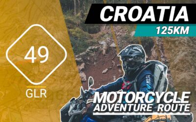
The GLR 49 Motorcycle Adventure Route
The GLR 49 motorcycle adventure route leads you for over 125 kilometers through the Primorje-Gorski Kotar County of Croatia and the Inner Carniola & South-east Slovenia regions of Slovenia. 78 of those kilometers will traverse over off-road sections. If the going gets tough, The Back-up Tracks will support you with 3 different sections. With a total of 3 connecting GLRs to this GLR 49, you’re able to continue to Adventurise the region. Let’s get going!
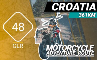
The GLR 48 Motorcycle Adventure Route
The GLR 48 motorcycle adventure route leads you for over 361 kilometers through the Goriška Coastal–Karst regions of Slovenia and the Istria and Primorje-Gorski Kotar County regions of Northern Croatia. 113 of those kilometers will traverse over off-road sections. If the going gets tough, The Back-up Tracks will support you with 13 different sections. With a total of 5 connecting GLRs to this GLR 48, you’re able to continue to Adventurise the region. Let’s get going!
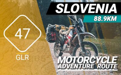
The GLR 47 Motorcycle Adventure Route
The GLR 47 motorcycle adventure route leads you for over 88,9 kilometers through the Goriška / Inner Carniola regions of Slovenia. 65,1 of those kilometers will traverse over off-road sections. If the going gets tough, The Back-up Tracks will support you with 4 different sections. With a total of 5 connecting GLRs to this GLR 47, you’re able to continue to Adventurise the region. Let’s get going!