| Sault - Embrun | 416km | ||
| 107km off-road | May / September |
Quick GLR 7 overview
The GLR 7 Motorcycle Adventure Route leads you for over 416 kilometers through the Drôme , Hautes-Alpes, and Alpes-de-Haute-Provence regions of Southern-France. 107 of those kilometers will traverse over off-road sections. If the going gets tough, The Back-up Tracks will support you with 10 different sections. With a total of 4 connecting GLRs to this GLR 7, you’re able to continue to Adventurise the region. Let’s get going!


GLR 7 Route info
You start your GLR 7 journey in Sault. The first 160 km will take you up north. With a variety of off-road and on-road sections, you start to head east from Recoubeau on. You make your way through the ravines in this very interesting area. A longer on-road section of 80 km will lead you past these steep climbs.
After making your way out of these ravines, the on-road and off-road sections follow each other up at a nice tempo. The final kilometers of the GLR 7 will lead you around Lake de Serre-Ponçon. Finally, after some decent kilometers, you’ll end this GLR in Embrun. From there on, the High Alps are at your feed!


GLR 7 Region
You’ll Adventurise with the GLR 7 three departments of south-east France. This route will cross Drôme in the South-East. After crossing the border with the department of Hautes-Alpes, your alpine adventure really starts! Read all about the region down below!
Drôme
Like many other departments, Drôme is named after the river which flows through the region. Drôme is also known as the northern gate to the Provence. You notice this by the many medieval castles, natural features, and the climate which gradually transitions. Drôme surrounds an exclave in the south, which belongs to the Vaucluse department.
The department can be split in two regarding its weather features. The north knows a more continental oriented climate. If you progress to the south, the Mediterranean climate gets overhand. Funny is that for us as Adventurisers, that the summers see more precipitation than the winters. This is caused again by the transition between the humid Mediterranean air and the somewhat colder northern winds. But don’t be fooled, the winters aren’t easier to ride! With an average temperature of 3°C in January, the winters are cold!


Hautes-Alpes
A fun historical fact about the region is that Napoleon passed through Gap when he returned after being exiled on Elba. After his defeat at Waterloo, the region was occupied by Austrian and Piedmontese (Italian) troops from 1815 to 1818. The Italians would return in the second World War. They occupied the region from the winter of 1942 to the end of summer in 1943. Remanence of this militarization is still visible in the form of fortifications and ruins.
Due to its mountainous nature, the region knows some extreme weather. The summers won’t last as long as in its neighboring Mediterranean regions. The first snow can be seen in October, especially on the high mountain passes. Therefore it’s advisable to check the weather before you head out on any of the GLRs in the region. Especially when you want to adventurise them outside the recommended period.
Alpes-de-Haute-Provence
First, you find the plateaux, hills, and valleys. Although this area only covers one-third of Alpes-de-Haute-Provence, it houses most of the population. It’s here where you find it’s bigger cities like Digne-Les-Bains, Manosque, Sisteron, and Barcelonnette.
Second, you have the Lower Alps and High Alps which cover the remaining area of the region. It’s here where a real Adventuriser comes to life. With peaks exceeding 3000 meters, it’s a special place within Europe.
Alpes-de-Haute-Provence knows several climates due to its mountainous nature. Where in the lower hills and valleys a Mediterranean climate dominates, it switches to an alpine climate in the Lower- and High Alps. This difference is also noticeable in vegetation and road surfaces. From dry Mediterranean brushes to the lush alpine fields, you find it all in this region.

Adventurising isn’t only about getting as fast from A to B! A Region has so much more to offer! That’s why I give you some suggestions about things to do while Adventurising the GLR 7.
Mont Ventoux
This is the highest mountain in the region. At a height of 1909 meters it stands out in the surroundings. Also known as the Beast of Provence, record-holding wind speeds are measured at 320 km/h at its peak. Just spend a day discovering this mighty mountain on foot.
more info
Les Gorges Du Toulourenc
Time to cool off during a hot summer day! Just relax a little near the water, or explore the ankle-deep gorges on foot! I would recommend bringing some shoes as the rocks can be quite sharp!
more info
Baronnies provençales Natural Regional Park
Rolling hills patched with lavender fields! It’s nice to ride around in this region, but it’s also lovely to explore this natural park on foot. I would recommend visiting early in the morning or just before sunset, as then you’ll smell the lovely fragrances of the lavender.
more info
Demoiselles Coiffées de Pontis
This fascinating rock formation is located near Embrun. This formation consists of several hoodoos. These are a set of narrowly-tapered rock columns, topped with a large rock balanced on the tip. You don’t believe me? Check it for yourself!
more info

Thank you for downloading the GLR 7! Good luck with Adventurising Europe. Speaking of Adventurising Europe, to keep the project going and free, we’re relying on a mix of sponsored advertisements and Adventuriser donations. Do you like what we’re doing and you want to support the project? Please consider a donation. You can read more about donations and support here.
The Adventurising Europe project is all about documenting Europe through the eyes of adventure riders. Do you want to contribute to this mission? Become an Adventuriser! As an Adventuriser you’re part of our community and you enjoy the benefits of accessing the back-up tracks of the GLR-Network. Also you receive our regular updates on the project. It’s completely free, so enlist now!
Continue your GLR 7 Adventure by connecting different GLRs. To make your life even simpler, I’ve put together all the options down below!
Connections in Sault
Do you want to explore the Mediterranean region? Take the GLR 5 down south. This 104-kilometer long route will entertain you with red sandy roads! Be aware, these roads are slippery as hell when wet! Are you in for the challenge? A total of 40 kilometers of off-road sections will add true adventure to your motorcycle adventure.


Connections in Embrun
You’re at the gates of the High Alps in Embrun. Take the GLR 30 for an epic adventure in the High Alps of Italy. Heading for the Stella Alpina Rally at Colle du Sommelier? The GLR 30 will show you the way. This 254-kilometer long GLR is a pearl in the GLR Network. With 126 km of off-road sections at altitude, this is for the real Adventurisers!
Not ready to head into Italy? Take the GLR 8 down south and explore the French side of the High Alps. With Tunnel du Parpaillon as the cherry on the cake with this Route. The GLR 8 sports 105 kilometers of which 33 are off-road. Be aware, if you’re too early in the season, some passes will be closed due to snow.
Explore.Ride.Adventurise.
Exploring Europe through the eyes of an adventure rider. Making Europe a better place for adventure riders by creating the GLR Network.
As an Adventuriser you get access to our special Back-up Tracks for the GLR-network. These routes function as a back-up when the going gets tough. In the event you need to circumnavigate a piece of the original GLR, the Back-Up Track will lead you via paved road to the next section.
Sign in to download this Back-up Track!

Support the Adventurising Europe project
As a Patron, you gain access to the latest 5 GLRs before Everyone else! That's at least 2,5 months! Besides that, you support 1 kilometer of that GLR. You enable me to continue the Adventurising Europe project and keep the GLR Network free. Please consider becoming a Patron if you think I provide any value to you.
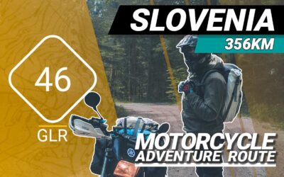
The GLR 46 Motorcycle Adventure Route
The GLR 46 motorcycle adventure route leads you for over 356 kilometers through the Upper- and Inner Carniola regions of Slovenia. 77.5 of those kilometers will traverse over off-road sections. If the going gets tough, The Back-up Tracks will support you with 8 different sections. With a total of 4 connecting GLRs to this GLR 46, you’re able to continue to Adventurise the region. Let’s get going!
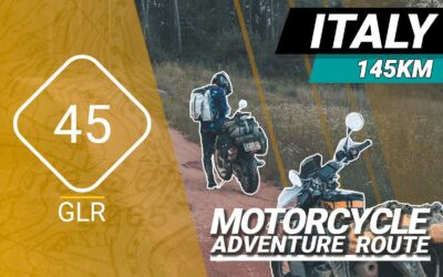
The GLR 45 Motorcycle Adventure Route
The GLR 45 motorcycle adventure route leads you for over 145 kilometers through the Friuli Venezia Giulia region of Northern Italy and the Nova Gorica province of Slovenia. 26.4 of those kilometers will traverse over off-road sections. If the going gets tough, The Back-up Tracks will support you with 6 different sections. With a total of 5 connecting GLRs to this GLR 45, you’re able to continue to Adventurise the region. Let’s get going!
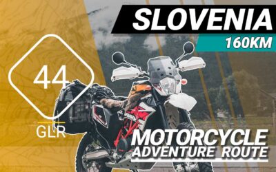
The GLR 44 Motorcycle Adventure Route
The GLR 44 motorcycle adventure route leads you for over 160 kilometers through the Carinthia region of Austria, Friuli Venezia Giulia region of Italy, and the regions of Tolmin and Nova Gorica in Slovenia. 2.7 of those kilometers will traverse over off-road sections. If the going gets tough, The Back-up Tracks will support you with 2 different sections. With a total of 5 connecting GLRs to this GLR 44, you’re able to continue to Adventurise the region. Let’s get going!