| Colmars - Embrun | 105km | ||
| 32.9km off-road | May / September |
Quick GLR 8 overview
The GLR 8 Motorcycle Adventure Route leads you for over 105 kilometers through the Hautes-Alpes and Alpes-de-Haute-Provence regions of Southern-France. 33 of those kilometers will traverse over off-road sections. If the going gets tough, The Back-up Tracks will support you with 1 big section. With a total of 4 connecting GLRs to this GLR 8, you’re able to continue to Adventurise the region. Let’s get going!


GLR 8 Route info
You start your adventure in Colmars. From there it’s going to be up north all the way. At first, you’re going to navigate over an on-road section for about 50 kilometers. After this longer on-road section, you’re at the trailhead of the Col du Parpaillon. This old military road will lead you to the famous tunnel at 2780 meters.
After crossing this dark, wet, and most of the time, cold tunnel, you descend back into the valley. Now at a lower altitude, you head to the finish in Embrun.
Be aware of the season on this GLR! I went to the tunnel at the end of June and it was still blocked by snow! The locals are most of the time well informed if the pass is open for motorcycles.


GLR 8 Region
With the GLR 8 you’re going to explore one of the most beautiful regions of France. The route crosses the High Alps of the Alpes-de-Haute-Provence and Haute-Alpes departments. Read more about the region down below!
Alpes-de-Haute-Provence
First, you find the plateaux, hills, and valleys. Although this area only covers one-third of Alpes-de-Haute-Provence, it houses most of the population. It’s here where you find it’s bigger cities like Digne-Les-Bains, Manosque, Sisteron, and Barcelonnette.
Second, you have the Lower Alps and High Alps which cover the remaining area of the region. It’s here where a real Adventuriser comes to life. With peaks exceeding 3000 meters, it’s a special place within Europe.
Alpes-de-Haute-Provence knows several climates due to its mountainous nature. Where in the lower hills and valleys a Mediterranean climate dominates, it switches to an alpine climate in the Lower- and High Alps. This difference is also noticeable in vegetation and road surfaces. From dry Mediterranean brushes to the lush alpine fields, you find it all in this region.


Hautes-Alpes
A fun historical fact about the region is that Napoleon passed through Gap when he returned after being exiled on Elba. After his defeat at Waterloo, the region was occupied by Austrian and Piedmontese (Italian) troops from 1815 to 1818. The Italians would return in the second World War. They occupied the region from the winter of 1942 to the end of summer in 1943. Remanence of this militarization is still visible in the form of fortifications and ruins.
Due to its mountainous nature, the region knows some extreme weather. The summers won’t last as long as in its neighboring Mediterranean regions. The first snow can be seen in October, especially on the high mountain passes. Therefore it’s advisable to check the weather before you head out on any of the GLRs in the region. Especially when you want to adventurise them outside the recommended period.
Adventurising isn’t only about getting as fast from A to B! A Region has so much more to offer! That’s why I give you some suggestions about things to do while Adventurising the GLR 8.
Clue de Barles
One of the most famous balcony roads in France! The hairpin curves and narrow tunnels make this road appear on the list of the most dangerous roads! Let’s see if it’s good enough for an Adventuriser!
more info
Col du Parpaillon
This is one of the main highlights of the GLR 8! An old military road will lead you up the mountain to a maximum of 2780 meters. Just before reaching the peak, you’ll dive into this 520 meters long cold, dark, and wet tunnel.
more info
Vallouise Valley
This valley is famous for its natural beauty! Some of the main highlights are the Glacier Blanc and Glacier Noir. Two glaciers in this valley which you still can visit on foot! You can park your bike at Pre Madame Carle.
more info
Demoiselles Coiffées de Pontis
This fascinating rock formation is located near Embrun. This formation consists of several hoodoos. These are a set of narrowly-tapered rock columns, topped with a large rock balanced on the tip. You don’t believe me? Check it for yourself!
more info

Thank you for downloading the GLR 8! Good luck with Adventurising Europe. Speaking of Adventurising Europe, to keep the project going and free, we’re relying on a mix of sponsored advertisements and Adventuriser donations. Do you like what we’re doing and you want to support the project? Please consider a donation. You can read more about donations and support here.
The Adventurising Europe project is all about documenting Europe through the eyes of adventure riders. Do you want to contribute to this mission? Become an Adventuriser! As an Adventuriser you’re part of our community and you enjoy the benefits of accessing the back-up tracks of the GLR-Network. Also you receive our regular updates on the project. It’s completely free, so enlist now!
Continue your GLR 8 Adventure by connecting different GLRs. To make your life even simpler, I’ve put together all the options down below!
Connections in Colmars
Your GLR 8 Adventure ended in Colmars and you’re looking for more? Great! In Colmars a few of the best GLRs come together. Take the GLR 6 if you want to continue your adventure to the west and eventually towards the Mediterranean coast. The GLR 6 navigates you for over 199 kilometers, of which 81 are off-road sections.
In my personal opinion, even a better option is the GLR 9! This 742 km long motorcycle adventure route will show you the Ligurian Alps like no other! At first, you head towards Monaco, which after you’ll follow the French/ Italian border up north. With 233 kilometers of off-road sections at altitude, this GLR won’t disappoint you.


Connections in Embrun
Even in Embrun, the Alps are at your doorstep! Take the GLR 7 west if you want to explore the lower regions of the French Alps. The GLR 7 navigates you for over 416 kilometers. With over 107 kilometers of off-road sections, this GLR will make you feel like a real Adventuriser!
Ready for even more roads at higher altitudes? Take the GLR 30 up north. This GLR will navigate you over the French border into Italy where the yearly Stella Alpina Rally is held. The in total 254-kilometer long GLR will navigate you for over 126 kilometers of off-road sections. That’s almost 50%! This is a must-do GLR in the region.
Explore.Ride.Adventurise.
Exploring Europe through the eyes of an adventure rider. Making Europe a better place for adventure riders by creating the GLR Network.
As an Adventuriser you get access to our special Back-up Tracks for the GLR-network. These routes function as a back-up when the going gets tough. In the event you need to circumnavigate a piece of the original GLR, the Back-Up Track will lead you via paved road to the next section.
Sign in to download this Back-up Track!

Support the Adventurising Europe project
As a Patron, you gain access to the latest 5 GLRs before Everyone else! That's at least 2,5 months! Besides that, you support 1 kilometer of that GLR. You enable me to continue the Adventurising Europe project and keep the GLR Network free. Please consider becoming a Patron if you think I provide any value to you.
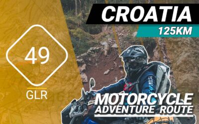
The GLR 49 Motorcycle Adventure Route
The GLR 49 motorcycle adventure route leads you for over 125 kilometers through the Primorje-Gorski Kotar County of Croatia and the Inner Carniola & South-east Slovenia regions of Slovenia. 78 of those kilometers will traverse over off-road sections. If the going gets tough, The Back-up Tracks will support you with 3 different sections. With a total of 3 connecting GLRs to this GLR 49, you’re able to continue to Adventurise the region. Let’s get going!
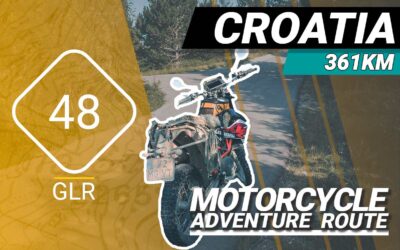
The GLR 48 Motorcycle Adventure Route
The GLR 48 motorcycle adventure route leads you for over 361 kilometers through the Goriška Coastal–Karst regions of Slovenia and the Istria and Primorje-Gorski Kotar County regions of Northern Croatia. 113 of those kilometers will traverse over off-road sections. If the going gets tough, The Back-up Tracks will support you with 13 different sections. With a total of 5 connecting GLRs to this GLR 48, you’re able to continue to Adventurise the region. Let’s get going!
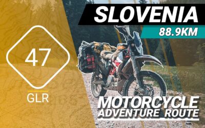
The GLR 47 Motorcycle Adventure Route
The GLR 47 motorcycle adventure route leads you for over 88,9 kilometers through the Goriška / Inner Carniola regions of Slovenia. 65,1 of those kilometers will traverse over off-road sections. If the going gets tough, The Back-up Tracks will support you with 4 different sections. With a total of 5 connecting GLRs to this GLR 47, you’re able to continue to Adventurise the region. Let’s get going!