| Lalouvesc - Passy | 428km | ||
| 30km off-road | April / October |
Quick GLR 28 overview
The GLR 28 motorcycle adventure route leads you for over 28 kilometers through the Ardèche, Drôme, Isere, Savoie, andHaute-Savoie Departments of Southern-France. 30 of those kilometers will traverse over off-road sections. If the going gets tough, The Back-up Tracks will support you with 6 different sections. With a total of 4 connecting GLRs to this GLR 28, you’re able to continue to Adventurise the region. Let’s get going!


GLR 28 Route info
Ready for the last section of the “highway” to the High Alps? The GLR 28 will show you the way! This adventure route departs in Lalouvesc. From here on, you don’t even need to ride 5 kilometers to hit the dirt! The first off-road section is almost 8 km long and shows you the way round in the hilly region of the Northern-Ardèche Department.
Half of the off-road sections are located in this region. Due to environmental laws, the off-road kilometers on this GLR are limited. Nonetheless, I’m proud to say that even though the percentage of dirt is relatively low, this adventure route covers an amazing piece of lower Alpine landscapes!
You continue your journey into the Drôme and Isère Departments. The hills start to rise in the lower mountain ranges covering the region. Twisty roads spiced up with stunning landscapes describe this 250-kilometer long on-road section the best.
As promised, a beautiful 15 km long off-road section right across the High Alps ends this motorcycle adventure route. With the Mont Blanc lurking in the distance, you end your journey in Passy. A town nearby Chamonix. For the connecting GLRs, I advise you to take a look at the connections section.


GLR 28 Region
With the GLR 28 you’re exploring 5 Departments of South-Eastern France! You’ll adventurise the departments of Ardèche, Drôme, Isère, Savoie, and the beautiful Haute-Savoie. Don’t wait and read all about these departments down below!
Ardèche


Drôme
Isère
As part of the original 83 departments formed during the French revolution of 1790, Isère is a department with a rich history. Besides it was forced to give up territory twice during its existence, it’s also known for its stunning landscapes.
The great diversity in altitude makes this region a great place to Adventurise! With its lowest point just 133m above sea level, and its highest at 4102m, you may understand why this department is beloved by many outdoor enthusiasts.
Climate wise, the border between a Mediterranean and Alpine climate lies just below its prefecture Grenoble, at the border of the neighboring department of Drôme. Because of the Alpine climate, I wouldn’t suggest visiting this region after September. I’ve encountered early snowfall myself at the end of the season!


Savoie
Savoie is part of the Rhône-Alpes region of South-Eastern France. Together with its northern neighboring Department Haute-Savoie, it has been part of the historic region of Savoy. This region was annexed by France in 1860. Besides the region’s rich history, which dates back to the prehistoric, it’s also widely known for its numerous ski resorts and mountainous beauty. Despite numerous old military roads, off-road riding is strictly forbidden in almost every commune.
Haute-Savoie
Haute-Savoie shares a rich history with its southern neighbor “Savoie”. Both have been part of the historic region of Savoy. This region was annexed by the French in 1860. The department’s prefecture is Annecy but is known for housing the capital of European mountaineering in Chamonix. As the name may imply, Haute-Savoie has a high average altitude. With its lowest point in the Rhône River Valley at 250m. It’s the highest point is the famous Mont Blanc at 4810 meters. The climate can be described as a land-alpine climate. Summers average a pleasant 25 degrees celsius. Perfect for exploring the region on a motorcycle. I don’t think I need to suggest that winter is off-limits for motorcycles. Snow starts to fall as early as the end of September!

Adventurising isn’t only about getting as fast from A to B! A Region has so much more to offer! That’s why I give you some suggestions about things to do while Adventurising the GLR 28.
Château de Crussol
Gorges de la Bourne
Vanoise National Park
Is it time to spend a day off the bike? Take a hike in the Vanoise National Park. Besides its diversity in wildlife like the Alpine Ibex and Eurasian Lynx, the park knows many vistas of the highest region of Europe!
more info
Lake Annecy
Fed by mountain springs, Lake Annecy is known for its clean water. Although I wouldn’t recommend it to take a sip, I would suggest taking a quick dip to cool off during those hot summer days. Note that many people do this as well, so it can be busy!
more info
Mont Blanc
The white mountain is lurking from a distance while you Adventurise the region. This 4810m high mountain is the second-highest peak on the European continent. Enjoy the many outdoor-related activities in the surrounding area on your day off the bike!
more info

Thank you for downloading the GLR 28! Good luck with Adventurising Europe. Speaking of Adventurising Europe, to keep the project going and free, we’re relying on a mix of sponsored advertisements and Adventuriser donations. Do you like what we’re doing and you want to support the project? Please consider a donation. You can read more about donations and support here.
The Adventurising Europe project is all about documenting Europe through the eyes of adventure riders. Do you want to contribute to this mission? Become an Adventuriser! As an Adventuriser you’re part of our community and you enjoy the benefits of accessing the back-up tracks of the GLR-Network. Also you receive our regular updates on the project. It’s completely free, so enlist now!
Continue your GLR 28 Adventure by connecting different GLRs. To make your life even simpler, I’ve put together all the options down below!
Connections in Lalouvesc
In Lalouvesc, you have either the opportunity to connect with the GLR 26 to continue your motorcycle adventure to the west. As part of the “Highway” to and from the High Alps, this 356-kilometer long route traverses for almost a third of the entire route over off-road sections.
If you want to continue to explore the French Department of Ardèche, choose the GLR 27. This 195 km long adventure route explores the entire Department from north to south.


Connections in Passy
Explore.Ride.Adventurise.
Exploring Europe through the eyes of an adventure rider. Making Europe a better place for adventure riders by creating the GLR Network.
As an Adventuriser you get access to our special Back-up Tracks for the GLR-network. These routes function as a back-up when the going gets tough. In the event you need to circumnavigate a piece of the original GLR, the Back-Up Track will lead you via paved road to the next section.
Sign in to download this Back-up Track!

Support the Adventurising Europe project
As a Patron, you gain access to the latest 5 GLRs before Everyone else! That's at least 2,5 months! Besides that, you support 1 kilometer of that GLR. You enable me to continue the Adventurising Europe project and keep the GLR Network free. Please consider becoming a Patron if you think I provide any value to you.
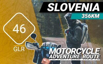
The GLR 46 Motorcycle Adventure Route
The GLR 46 motorcycle adventure route leads you for over 356 kilometers through the Upper- and Inner Carniola regions of Slovenia. 77.5 of those kilometers will traverse over off-road sections. If the going gets tough, The Back-up Tracks will support you with 8 different sections. With a total of 4 connecting GLRs to this GLR 46, you’re able to continue to Adventurise the region. Let’s get going!
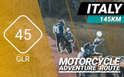
The GLR 45 Motorcycle Adventure Route
The GLR 45 motorcycle adventure route leads you for over 145 kilometers through the Friuli Venezia Giulia region of Northern Italy and the Nova Gorica province of Slovenia. 26.4 of those kilometers will traverse over off-road sections. If the going gets tough, The Back-up Tracks will support you with 6 different sections. With a total of 5 connecting GLRs to this GLR 45, you’re able to continue to Adventurise the region. Let’s get going!
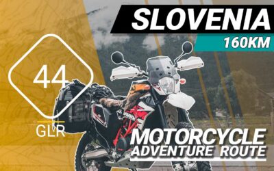
The GLR 44 Motorcycle Adventure Route
The GLR 44 motorcycle adventure route leads you for over 160 kilometers through the Carinthia region of Austria, Friuli Venezia Giulia region of Italy, and the regions of Tolmin and Nova Gorica in Slovenia. 2.7 of those kilometers will traverse over off-road sections. If the going gets tough, The Back-up Tracks will support you with 2 different sections. With a total of 5 connecting GLRs to this GLR 44, you’re able to continue to Adventurise the region. Let’s get going!