| Montfalgoux - Lalouvesc | 357km | ||
| 102km off-road | April / October |
Quick GLR 26 overview
The GLR 26 motorcycle adventure route leads you for over 357 kilometers through the Lozère, Cantal, and Haute-Loire departments of Southern-France. 102 of those kilometers will traverse over off-road sections. If the going gets tough, The Back-up Tracks will support you with 25 different sections. With a total of 4 connecting GLRs to this GLR 26, you’re able to continue to Adventurise the region. Let’s get going!


GLR 26 Route info
The GLR 26 is part of the fastest route to the High Alps. You start your motorcycle adventure in the rolling hills of Montfalgaux. Almost right from the start, you head up north via a 15-kilometer long off-road section. If you wish not to start this route with an off-road section, please see the back-up tracks. The starting direction differs from the main route.
You traverse the Regional Park l’Aubrac almost by its entire length. Nearby Saint-Flour, you cross the river Truyère to head eastwards. It’s here again where a 15-kilometer long off-road section spices up your adventure. After Brioude, the off-road sections start to thin out a little due to the local environmental laws.
You cross two natural parks while heading for your destination in Lalouvesc. First, you explore the southern tip of the Livradois-Forez Natural Park. Second, you hit the outer edges of the Pilat Natural Park, just south of Lyon. Although this adventure route knows a little less off-road sections in the second half, it’s still an amazing route if you want to explore the natural beauty of France.
At your destination in Lalouvesc, you have several options to continue your adventure. For more about the connection GLR routes, see down below!


GLR 26 Region
With the GLR 26 you’re exploring the interior of France. You’ll adventurise the departments of Lozère, Cantal, and Haute Loire. Don’t wait and read all about these departments down below!
Lozère
Lozère is known to be the least populated department of France. With most of its population living in its prefecture Mende. The department was created during the French Revolution of 1790 from the former province of Languedoc. The geography of Lozère is diverse, with a total of four different mountain ranges covering the department.
In the north-west, you’ll find the plateau of Aubrac. In the north, north-east you find the granite Margeride mountains. Further to the south-west, the Causses are a series of limestone plateaus rise from the landscape. Finally, in the south-east, you’ll find the highest peak of Mont lozère at a total of 1,702 meters in the Cévennes. A remarkable fact is that the region has one of the lowest rates of unemployment, caused by a long-standing tradition whereby the younger population emigrates to larger cities outside the department.


Cantal
As part of the Auvergne-Rhône-Alpes region, Cantal is a landlocked department located in the middle of France’s central plateau. Among us, as adventurers it’s known as one of the most sparsely populated areas of France, with a population of a little below 150.000. Most of them are located in and around its prefecture Aurillac. Besides this low overall population, Aurillac is also known for its remoteness to any major highways.
The geography of Cantal adds to its remoteness. The Cantal range consists of a group of extinct volcanoes. The peaks are long gone but have left a hilly inaccessible landscape. Its highest peak reaches an elevation of 1858 meters at Plomb du Cantal.
While the summers can be pleasant, Cantal is known for its summer storms. While exploring the amazing landscape of this department, I suggest keeping an eye on the weather forecast. In winter, temperatures of minus 15 degrees aren’t uncommon. Snow can remain for six months! If you’re looking for an adventure in the season, I would recommend Cantal.
Haute Loire
As part of the Auvergne-Rhône-Alpes region of Southern-France, Haute-Loire is a landlocked department. Named after the Loire river, it is best known for the Loire Valley and the surrounding mountains of the Massif Central. Its prefecture Le Puy-en-Velay is centrally located and inhabits most of its residents.
Geologically this department knows four mountain ranges, all running from north to south. Almost two-thirds of the department has an average altitude of over 800 meters, making this region extremely hilly.
For us as adventurisers, this region knows stricter off-road riding laws due to the Livradois-Forez Natural Park to the North. Other off-road sections consist of green lanes and agricultural roads.
The climate is comparable with the rest of the region and is known for its Mediterranean influences. This means that summers can be hot and dry. Freshwater sources are scarce, so bring enough water with you!

Adventurising isn’t only about getting as fast from A to B! A Region has so much more to offer! That’s why I give you some suggestions about things to do while Adventurising the GLR 26.
Viaduc de Garabit
This railway viaduct was constructed between 1882 and 1884. Designed by Gustave Eiffel himself, this is a must-see in the region! You don’t even need to ride extra for this because the GLR 26 passes right in front of it.
more info
Resistance Museum Mont Mouchet
Learn about the local history of the Second World War and how the resistance stopped the German advance into Southern-France!
more info
Ravin de Corbœf
Visit this 500 meters long Canyon on your day off! Explore the local geography or the museum nearby.
more info
Massif du Mézenc
This remnant of a volcano sticks out in its surroundings. The highest point reaches 1753 meters above sea level. A perfect place to visit for a day of hiking!
more info

Thank you for downloading the GLR 26! Good luck with Adventurising Europe. Speaking of Adventurising Europe, to keep the project going and free, we’re relying on a mix of sponsored advertisements and Adventuriser donations. Do you like what we’re doing and you want to support the project? Please consider a donation. You can read more about donations and support here.
The Adventurising Europe project is all about documenting Europe through the eyes of adventure riders. Do you want to contribute to this mission? Become an Adventuriser! As an Adventuriser you’re part of our community and you enjoy the benefits of accessing the back-up tracks of the GLR-Network. Also you receive our regular updates on the project. It’s completely free, so enlist now!
Continue your GLR 26 Adventure by connecting different GLRs. To make your life even simpler, I’ve put together all the options down below!
Connections in Montfalgoux
You’ve explored the rolling hills of the l’Aubrac Natural Park. Now you have to make a decision in which direction to head to. With the GLR 1, you’ll head east. This 226-kilometer long adventure route guides you towards the Ardèche region. With over 61km of varied off-road sections this is an adventure worthy route to continue your journey.
Or you head south with the GLR 10. This 326-kilometer long route guides you through the Cévennes region. With a high interval of off-road sections, this route is adventurous at least! With a total of 116km of off-road sections, you won’t be bored.


Connections in Lalouvesc
You’ve ended up in Lalouvesc where you can continue your motorcycle adventure in two directions. If you’re looking for the fastest route to the High Alps, choose the GLR 28. This 428-kilometer long route is designed to guide you via the best views to higher altitudes. Although most of the route traverses over on-road, the GLR 28 knows 30 kilometers of off-road sections.
If you’re heading for the Mediterranean or want to take the more adventurous route, choose the GLR 27. This route guides you for over 195 kilometers to the south where you have even more options to continue your adventure!
Explore.Ride.Adventurise.
Exploring Europe through the eyes of an adventure rider. Making Europe a better place for adventure riders by creating the GLR Network.
As an Adventuriser you get access to our special Back-up Tracks for the GLR-network. These routes function as a back-up when the going gets tough. In the event you need to circumnavigate a piece of the original GLR, the Back-Up Track will lead you via paved road to the next section.
Sign in to download this Back-up Track!

Support the Adventurising Europe project
As a Patron, you gain access to the latest 5 GLRs before Everyone else! That's at least 2,5 months! Besides that, you support 1 kilometer of that GLR. You enable me to continue the Adventurising Europe project and keep the GLR Network free. Please consider becoming a Patron if you think I provide any value to you.
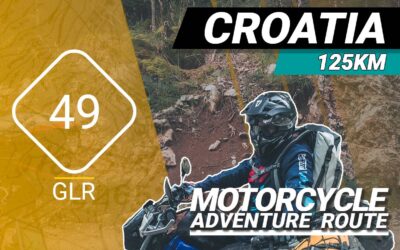
The GLR 49 Motorcycle Adventure Route
The GLR 49 motorcycle adventure route leads you for over 125 kilometers through the Primorje-Gorski Kotar County of Croatia and the Inner Carniola & South-east Slovenia regions of Slovenia. 78 of those kilometers will traverse over off-road sections. If the going gets tough, The Back-up Tracks will support you with 3 different sections. With a total of 3 connecting GLRs to this GLR 49, you’re able to continue to Adventurise the region. Let’s get going!
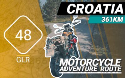
The GLR 48 Motorcycle Adventure Route
The GLR 48 motorcycle adventure route leads you for over 361 kilometers through the Goriška Coastal–Karst regions of Slovenia and the Istria and Primorje-Gorski Kotar County regions of Northern Croatia. 113 of those kilometers will traverse over off-road sections. If the going gets tough, The Back-up Tracks will support you with 13 different sections. With a total of 5 connecting GLRs to this GLR 48, you’re able to continue to Adventurise the region. Let’s get going!
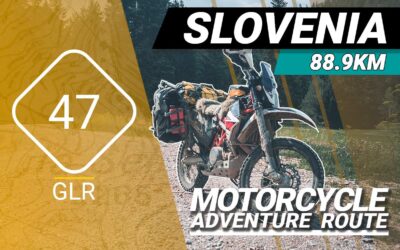
The GLR 47 Motorcycle Adventure Route
The GLR 47 motorcycle adventure route leads you for over 88,9 kilometers through the Goriška / Inner Carniola regions of Slovenia. 65,1 of those kilometers will traverse over off-road sections. If the going gets tough, The Back-up Tracks will support you with 4 different sections. With a total of 5 connecting GLRs to this GLR 47, you’re able to continue to Adventurise the region. Let’s get going!